Shafbergspitze, it can be lonely at the top.
Maps can be studied, routes can be memorised and directions can be given. Usually this preparation results in well executed tours and a general sense of agreement between map and reality. This time however, I managed to screw up even though the preparations were dare I say german in their meticulousness. The sense of despair is always close when map and reality show big discrepancies. However, it should be remembered that fortune favours the bold, and usually walking uphill is a sure way to reach the summit, eventually.
I will start from the beginning, riding along the road over a little pass in the morning sun to reach the destination of this first leg of the trip, Wolfgangsee.
 Sun shining through clouds on the more and more red leaves of the Austrian forests
 Wolfgangsee, and Shafbergspitze rising to the left
 Shafbergspitze in all its might, the actual summit just hidden behind the cloud. A sign of things to come.
The way up Shafbergspitze was supposedly straightforward, a long grind on a dirt road would take me between half and three quarters of the 1200m climb, leaving me to push and carry the last bit to the summit. Dirt roads are good for climbing, if they are not too steep or rocky (yes, I'm looking at you Colorado!) they offer relatively efficient and pain free elevation gain. Orientation is also supposedly easy, just stay on the road you know. Anyhow, the crucial ingredient is to actually find the correct dirt road, otherwise one is left in the cold.
 This is not a dirt road now, is it?
That is where the map comes in, and its agreement with reality. This time I failed miserably to make sense of the map, and I still believe there are more roads in reality than what the map made out. Tired of trying to make sense of the nonsensical map, I just started carrying my bike up the trail, which is the obvious but considerably less energy efficient way to reach the summit. In the interest of full disclosure, there was a fair bit of bushwhacking involved before I actually reached the trail, not really helping with the whole energy efficiency thing.
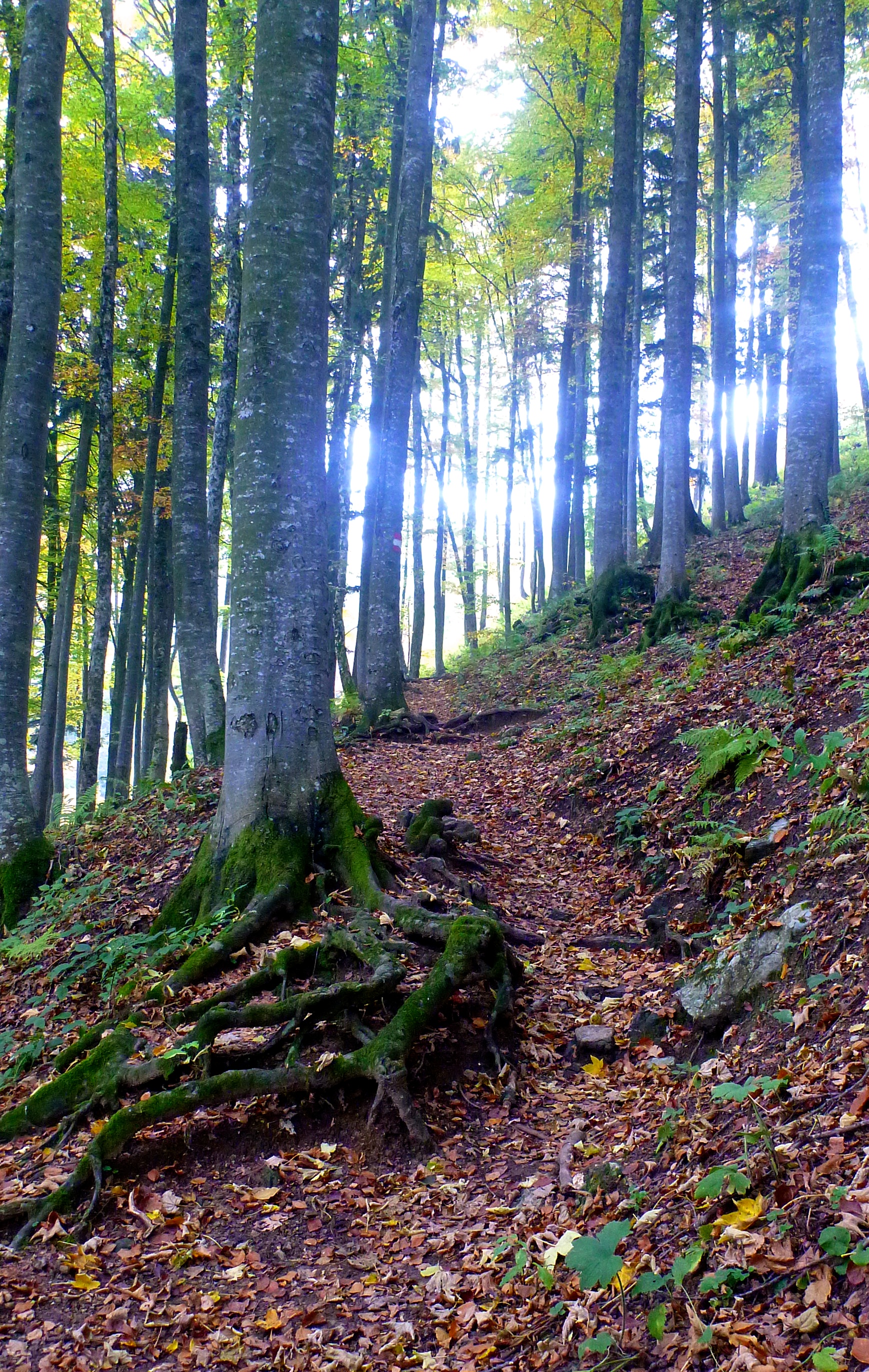 More carrying, more stunning trail
Finally I reached the tree line, and I got a glimpse of my objective.

 Happy and with a bike on the shoulders, getting used to it after 1000m climbing this way
The weather sorted itself out at elevation, the sun was shining down on the clouds below me, and I took a long break to eat (what I carried with me off course, no restaurant cheating here!) and enjoy the views.
 Pink orange, clouds, alps and lakes.
 I can (not) see my house from here, even though its somewhere below those clouds
 More clouds, just because I can
 Last one, promise!
The way down was fairly straightforward, nothing too steep, extreme or exposed. A few nosewheelie switchbacks, a bunch of stairs and rocks in the alpine and tons of roots and leaves in the trees. 1200m of great descending, smoking brake pads, hooting and hollering. Sometimes life is not too bad.
 The old Five having a rest just below tree line.
Thanks again to Fabi for having me, and for pointing me in the right directions. (I just need to learn how to follow those directions.)