Djupfjordheia, our first ride on Lofoten and a rude awakening
After a couple of days with bad weather we woke up on the campsite in Moskenes to clearing skies and a view over the faint mountains of the Norwegian mainland in the distance on the other side of the fjord.
We had decided on a trail when looking on the map, it seemed like a fairly long but quite mellow out-and-back ride to Djupfjordsheia and ultimately Hermanndalstinden, 1029masl. I had a bit of a cold and possibly a little fever, but was determined to not let any good weather riding slip away so off we went. The good thing about an out-and-back ride is the obvious fact that one returns the same way, which leaves the option of cutting the ride short at any desired time. Also, starting at sea level and climbing means that said retreat will be an easy one, at least in theory.
In the beginning all went as planned. The usual faff to find the trailhead, the realization that it was much hotter than anticipated when the sun bakes on the mountainside, and some mellow spinning in the granny gear interrupted by pushing when so required. What was surprising was that the soil was red like in Toscana, very cool.
Then, after passing a little lake it turned steep, rocky and technical. Hiking up, every section was of the sort “this might go, if I hit the exact right line and have a good day”. Then it went a bit more Lofoten. When the mountain turns steep, instead of making swichbacks like all normal and sound people do, the Norwegians just take the fall line, possibly hanging a chain on the side of the trail resembling some kind of Via Ferrata.
Being a swede, I expect things in a certain way. For example, if there is a hiking trail marked on the map, I expect it to be mostly, if not all ridable going downhill. Sure, sometimes it might get steep, hairy or even scary, but this was something different. If one needs to hold on to a chain just to get up a rock slab (with quite some exposure I might add), getting down is going to be very very scary indeed. Obviously we were not in Kansas anymore.
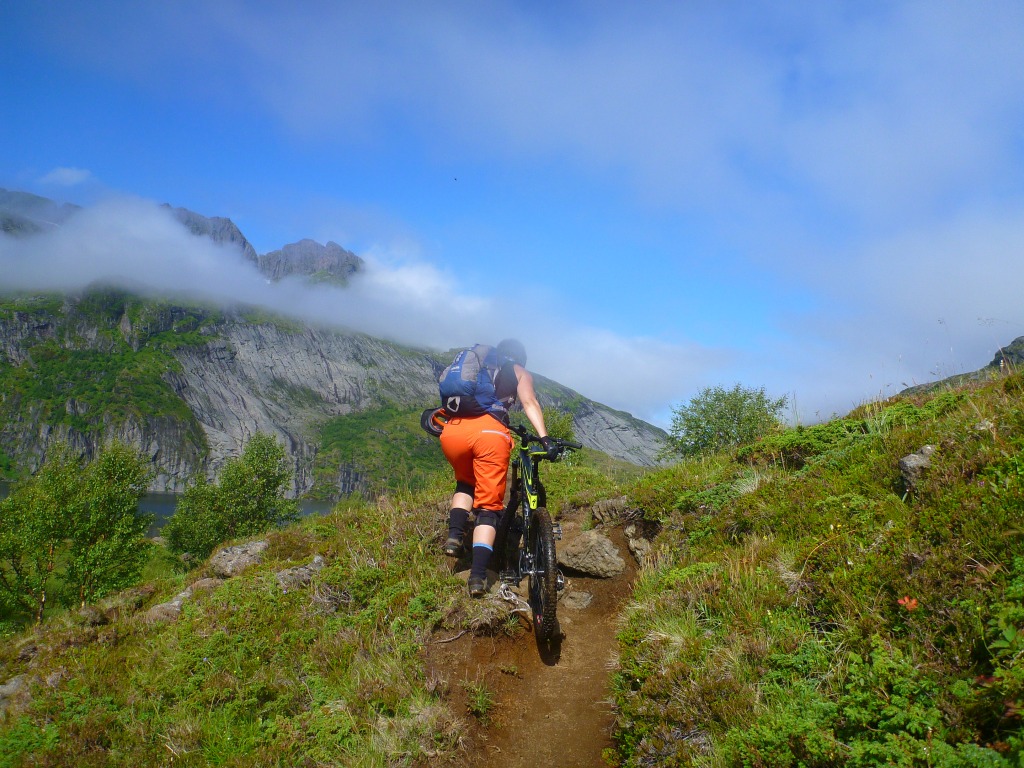
 Slightly less steep part, where i actually dared to snap a photo
After the climb the trail turned flat for a while, before we reached another steep part, this one with loose rocks and some water running here and there. The gradient was again of the “this might just go, on a good day” sort, so we carried on, in the most literal sense of the word.
However, after a while we reached another one of those impossible inclines, and we decied to call it quits.
 The view in question, with the hiker who snapped the previous pic
We left the bikes and walked up to the summit just to see the view, and realized how much easier it is to walk when not having to carry a bike as well.
 View from the summit of Djupfjordsheia
As you might have guessed, this was were we turned around. Judging from the map, we had done the least steep part of the trail, thus going on seemed optimistic at best. The ride down was spectacular. Exposed, scary, steep, flowy, technical, it had everything. Most of it was ridable, but some parts were just too steep, exposed and dangerous.
 Maria enjoying some creative line choices. One can se the trail down on the plateau, there was a lot of elevation lost in one bite
 On the plateau the trail was more flowy and less scary
After enjoying equal parts great riding and near death experiences we agreed that we needed more detailed maps so we could really study the contour lines and make sure they did not get too close to each other. We also changed tactics, we now looked for the flattest trails we could find on the map (except for those going right by the shore of some fjord of course), which would prove to be a more successful strategy.
 The sun sets on the harbor after a great day in the mountains.


